


- Federal flood maps exclude many high-risk properties, particularly in urban areas where heavy rain causes most of the damage.
- First Street identifies 13M flood-prone homes outside FEMA’s designated zones.
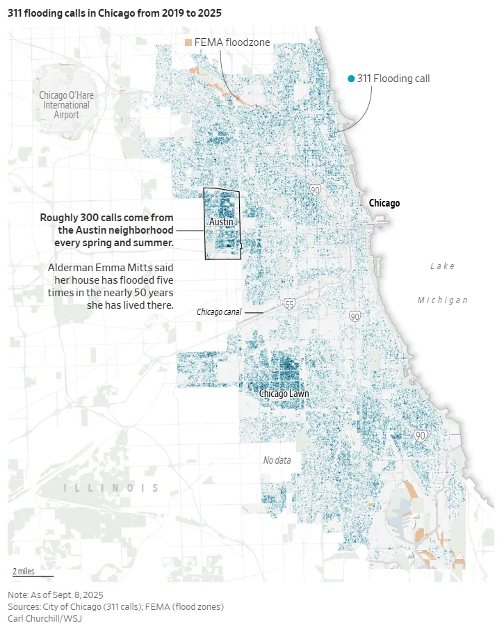
- Cities like Chicago and Milwaukee face frequent basement flooding, often with no official flood zone warning.
- FEMA lacks the resources and speed to update maps in step with climate-driven flood changes.
Flood Risks Often Go Undetected
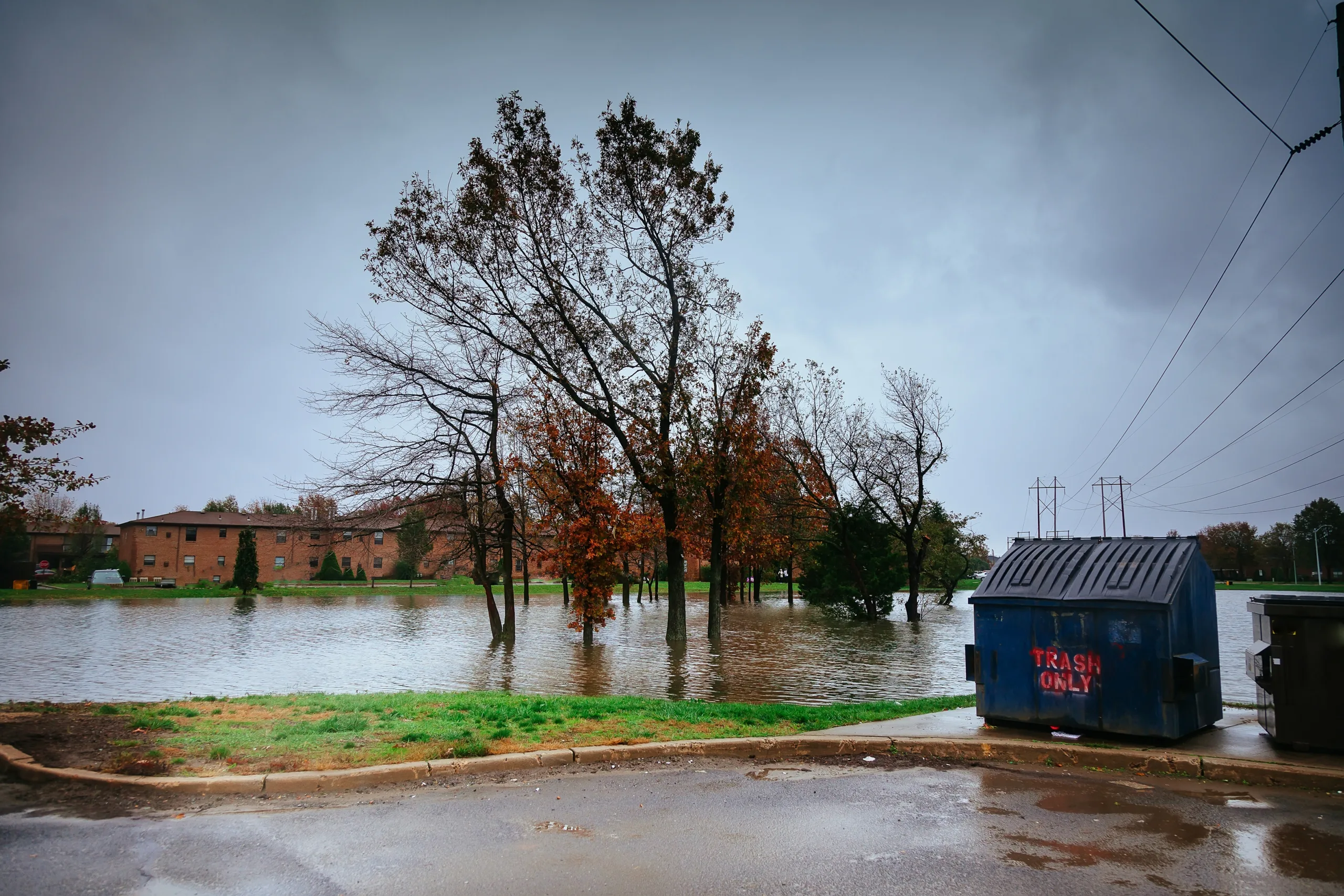
According to The WSJ, many homeowners live with hidden flood risks because FEMA maps don’t reflect today’s climate realities. In Chicago’s Austin neighborhood, Shirley Howard’s home has flooded three times in 30 years. Still, her lender never required flood insurance. FEMA’s map says her area is a no-flood zone.
But her basement tells a different story.
A Growing Gap in Risk Data
FEMA currently identifies around 8M homes as flood-prone. However, First Street Foundation estimates another 13M properties face the same level of risk—yet fall outside FEMA’s designated flood zones.
These include roughly 500,000 homes in major cities like New York, Houston, Los Angeles, Philadelphia, and Chicago.
Urban Flooding Hits Hard
In many cities, stormwater systems can’t keep up with extreme rainfall. In 2023, sewage backed up through Howard’s toilet when three feet of water filled her basement. Her grandson stood waist-deep in it, holding the television above his head.
Similar scenes played out in Milwaukee and Asheville, North Carolina. In both places, recent floods hit areas that FEMA does not mark as high-risk.
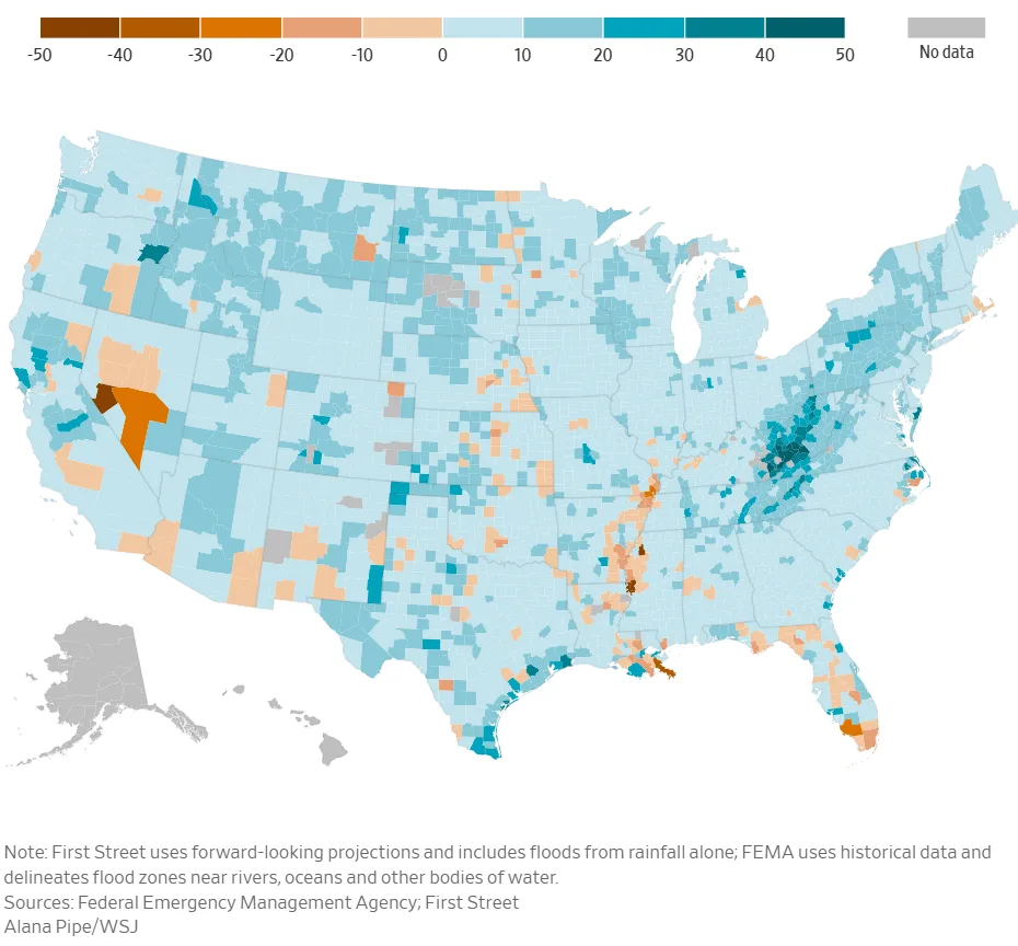
Why FEMA Maps Fall Short
FEMA builds maps using historical flood data, often over a decade old. They don’t account for how climate change intensifies rainfall or how new developments affect runoff. In contrast, First Street uses forward-looking models that include rain-only flooding—now the most common source of damage in cities.
Updating FEMA maps can take up to six years. Local opposition and funding limits slow the process. FEMA spends about $400M a year on mapping, less than what it pays in annual interest on disaster program debt.
Get Smarter about what matters in CRE
Stay ahead of trends in commercial real estate with CRE Daily – the free newsletter delivering everything you need to start your day in just 5-minutes
An Insurance System on Hold
The National Flood Insurance Program (NFIP), which relies on FEMA maps, struggles to stay operational. Congress frequently delays reauthorizing it, sometimes shutting it down altogether. During those periods, FEMA can’t issue new policies, stalling home sales and leaving properties unprotected.
Most homeowners outside mapped flood zones skip flood insurance altogether. After Hurricane Harvey, studies found homes with coverage were far less likely to default—yet most covered homes were inside FEMA zones.
Rising Costs for Homeowners and Taxpayers
Without accurate maps, people underestimate their flood risk. Many don’t buy insurance. When disaster strikes, they rely on FEMA aid—at a cost of $12B a year to taxpayers.
Howard received $4,445 to help repair her basement. In North Carolina, Kyndall Monroe got the maximum $40,000 after Hurricane Helene sent five feet of water into her home—200 yards outside a mapped flood zone.
Monroe and her husband had bought the house in 2021 to raise a family. After back-to-back floods, they’ve decided to move. “We can’t go through this again,” she said.